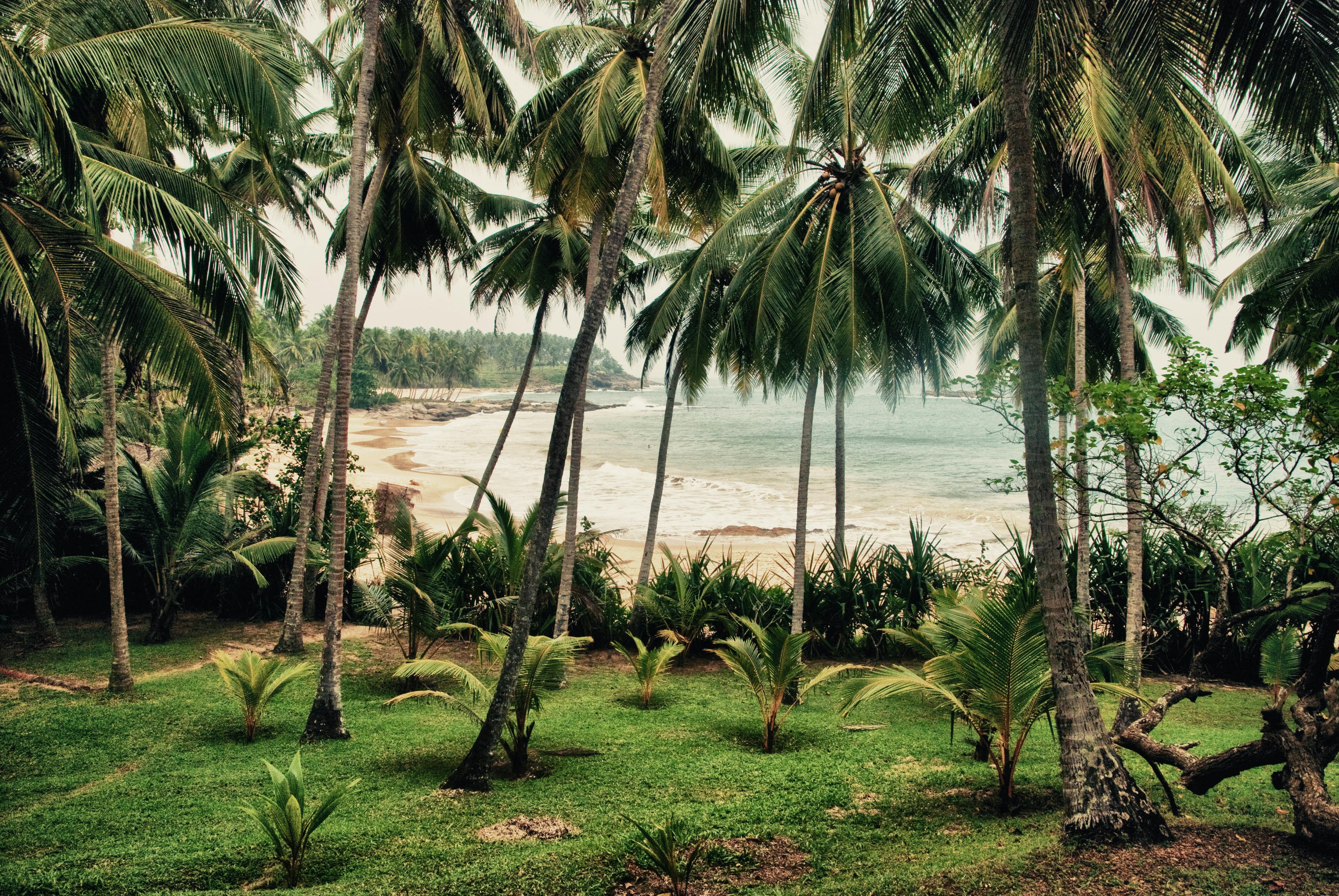
Mirissa Beach
A small town on Sri Lanka's south coast, Mirissa (Sinhala: මිරිස්ස, romanised as Mirissa; Tamil: மிரிஸ்ஸ, romanised as Miris'sa) is situated in the Southern Province's Matara District. It is located at an elevation of 4 meters (13 feet) above sea level and is roughly 150 kilometres (93 miles) south of Colombo. Mirissa is a well-liked tourist attraction because to its beach and nightlife. In addition, it is a fishing port and a major spot on the island for whale and dolphin viewing. The south coast's biggest fishing port, Mirissa, is well-known for its butterfish, mullet, snapper, and tuna. The town began to see a sharp rise in tourism in the mid-1990s after the first tourist accommodations were constructed in 1980. [2] The 2004 Indian Ocean earthquake triggered a tsunami that hit Mirissa, destroying or damaging many residences, guesthouses, shops, schools, and temples. Fourteen people were confirmed dead. The town is roughly 2 kilometres (1+1/4 miles) west of Mirissa railway station, which is on the Coastal or Southern Rail Line (which connects Colombo through to Matara). It is also roughly 13 kilometres (8 miles) from the Kokmaduwa Interchange of the Southern Motorway. Mirissa is situated on the A2 Highway, which connects Colombo to Wellawaya.
Mihintale Rajamaha Viharaya
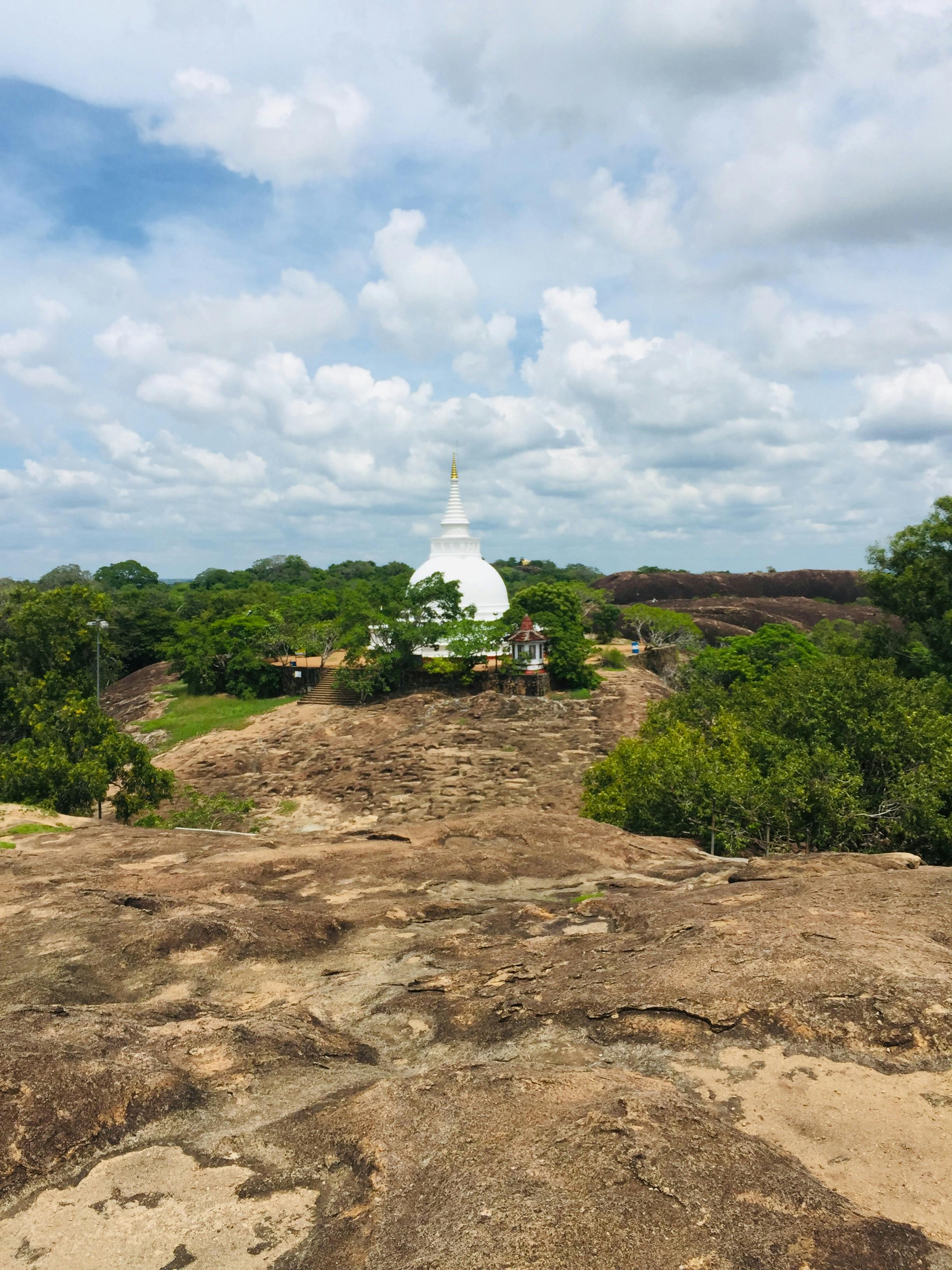
Mihintale is a Sri Lankan mountain summit close to Anuradhapura. The Buddhist monk Mahinda and King Devanampiyatissa are said to have met there, establishing Buddhism's presence in Sri Lanka, according to Sri Lankans. It is currently a place of pilgrimage and is home to a number of abandoned buildings and religious monuments. The 1,000-foot (300-meter) "Missaka Pabbata" is located near the Anuradhapura-Trincomalee Road, about 12.5 km (7.8 mi) east of Anuradhapura. It is one of the highest peaks in a mountain range. On the full moon day of the month of Poson (June), Thera Mahinda travelled from India to Sri Lanka, where he met King Devanampiyatissa and spread Buddhism, according to Dipavamsa and Mahavamsa. Sri Lankan Buddhists hold the historic location of this gathering in high regard. Therefore, in the month of Poson, Buddhists conduct their pilgrimage to Anuradhapura and Mihintale. Mahinda was the son of Emperor Ashoka of India.Inspired by a monk called "Nigrodha," King Ashoka converted to Buddhism. After seeing the destruction brought about by expansionist conflicts, the King was quite unhappy. His life changed after he met this quiet young monk, and he decided to give up war. He was committed to spreading the peace message. Consequently, his son and daughter became enlightened Arahats and were ordained as Buddhist monastics. Ashoka sent his son Mahinda to the island of Lanka, also called "Sinhalé," in an effort to promote peace rather than war. King Devanampiyatissa, a friend of his, governed this island. Thus, “Mahinda” was the Indian name, which in Sinhalé, became “Mihindu.” Mihin-Thalé literally translates to "plateau of Mihindu" in Sinhala. Located atop a hill, this plateau is where Arahat Mihindu is said to have summoned King Devanampiyatissa by name in order to prevent him from shooting a deer. Thus, "Mihin Thalé" is a phrase that is unique to Sinhala. Large steps were built to climb Mihintale as early as antiquity. King Devanampiyatissa is said to have built 68 caves and a vihara for the Bhikkhus to live in. A series of Buddhist monasteries, or viharas, with all the auxiliary structures typical of monasteries of that era progressively expanded at Mihintale.
Nine Arch Bridge
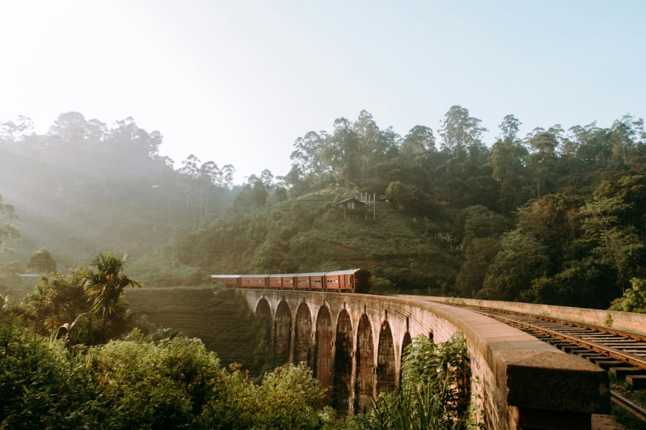
The Bridge in the Sky, also known as the Nine Arch Bridge (Sinhala: ආරුක්කු නමයේ පාලම; Tamil: ஒன்பது வளைவுகள் பாலம்) is a viaduct bridge in Sri Lanka and one of the best examples of colonial-era railway construction in the nation.[5] The bridge was built to handle a difficult nine-degree bend and a steep incline. Completely constructed by local workers under British supervision, the project presented several logistical difficulties, such as challenging terrain and material transportation. Since its completion in 1919, the bridge has remained sturdy, displaying creative engineering solutions like locally made sand-cement facing blocks and concrete cornice blocks for arch support.[6] Between the Ella and Demodara train stations in Demodara is where you can find it. The bridge's innovative architecture and the abundance of greenery on the surrounding hillsides have contributed to a steady rise in tourism in the area.[5] With the consent of M. Cole Bowen, the Chief Construction Engineer, Railway Extensions, Harold Cuthbert Marwood, the engineer in charge of that section of the railway, had completed the work.[6] The renowned Ceylonese engineer and inventor D. J. Wimalasurendra was the principal designer and project manager of the "Upcountry Railway Line of Ceylon" project. Harold Cuthbert Marwood of the Ceylon Government Railway's Railway Construction Department designed the viaduct. All of the records, including the plans and drawings, are detailed in the 1923 report "Construction of a Concrete Railway Viaduct in Ceylon," which was published by the Engineering Association of Ceylon. According to popular belief, P. K. Appuhami, a local Ceylonese builder, worked with British engineers to construct the bridge.Although Appuhami's involvement in the bridge's construction is not supported by any written records, the folklore is still a part of the local culture. Rumour had it that the steel allotted for the bridge had been diverted to British war-related projects at the time of construction, which coincided with the start of World War I. As a result, work stalled, and the locals decided to build the bridge out of stone bricks and cement without any steel—aside from the rails and pins holding them in place, of course.
Talpe Beach
Talpe Beach is a beautiful and undiscovered gem in the Galle District of southern Sri Lanka. Away from busy tourist destinations, its gorgeous, immaculate, golden sand and glistening clear waters entice travellers looking for tranquil, relaxed vacations. located between the well-known beaches of Unawatuna and Koggala, 15 km south of Galle. Soft golden sands and calm, shallow waters—ideal for swimming and relaxation. Stunning sunsets with hues of orange, pink, and gold, making it a photographer’s paradise. Less commercialized compared to nearby beaches, offering a peaceful retreat. Swimming & Sunbathing – Safe, gentle waves perfect for families. Koggala Beach & Lake – Famous for stilt fishermen and a turtle hatchery. Galle Fort – A UNESCO World Heritage Site just a short drive away. Jungle Beach – A secluded cove near Unawatuna, great for snorkeling. Snorkeling & Diving – Explore coral reefs and marine life in clear waters. Fishing & Boat Rides – Experience traditional stilt fishing or take a boat trip to Koggala Lake. Ayurveda & Wellness – Nearby spas and yoga retreats offer rejuvenating therapies. Cosy homestays, resorts on the beach, and boutique villas. Cafés and restaurants with fresh seafood that serve international and Sri Lankan food. The best time to go is between November and April, when the seas are calm and dry. Perfect For: Families seeking a peaceful beach experience, couples, and lone travellers.